Discover the rich history of Blockhouses at our museum located at the beginning of the Mule Trail hike on the R512 Pelindaba Road. Immerse yourself in the past before embarking on a 6km circular hike. Conclude your day with a delightful meal and drinks at 1969, our on-site pub and restaurant.
About The Blockhouse Museum
Significance of the location
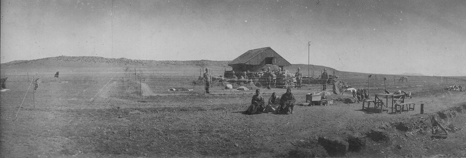
Following the capture of major population centers in June 1900, the British Forces shifted to a mobile guerrilla phase. To thwart Boer Commando Movement, the British initiated a blockhouse building campaign along the Magaliesberg escarpment. This natural barrier, with steep cliffs impossible to climb, became a key defense line. The main passes through the escarpment were heavily fortified with blockhouses. Approximately 80 blockhouses were erected between Pretoria and Rustenburg, securing the region and funneling movement to the south and west.
The Blockhouse Museum
Blockhouses along the Magaliesberg
Most blockhouses along the range were of the Rice Pattern Type, featuring dry stone wall construction topped with the distinctive corrugated iron-shield designed by Major Rice. Explore the remnants of these historical structures as they dot the landscape along the escarpment. The map illustrates the blockhouse line from Pretoria to Rustenburg, highlighting defended passes and major battles like Nooitgedaght, Kalkheuwel, and Silkaatsnek. Discover and record old blockhouse sites, an ongoing effort to preserve our heritage.
For more in-depth exploration, delve into the Block Houses on the Mule Trail and the renowned Battle of Kalkheuwel here.
Unveiling the Strategy
During the Anglo-Boer War, the construction of blockhouses was not part of the original British strategy. Instead, it emerged as a response to the offensive operations of the Boer Forces. Following the invasion of Natal, the Cape Colony, and the subsequent invasion of the Boer Republics, the British found their lines of communication from the coast to inland forces increasingly stretched, reliant on railway lines.

Defending Key Points
The first Elliot Wood Pattern Blockhouses were strategically placed to safeguard the largest and most vulnerable railway bridges on the line from Cape Town to the border with the Orange Free State. Constructed in pairs to cover expansive bridge spans, these blockhouses, located at key points like Wolseley, Dwyka, Riversford, and Stormberg Junction, also served as bases for supplying other outlying blockhouses.
Defending Railway Lines
As the war entered the Guerrilla Phase, over 7,000 Rice Pattern Blockhouses were deployed at ½ mile intervals to protect the actual railway tracks. Some blockhouses were positioned within touching distance of trains, and the railway line was further fortified with a six-strand barbed wire fence and a counter-mobility trench to hinder Boer Commando movement.
Extending the Net
Recognizing the vastness of South Africa, blockhouse lines were extended ‘across-country,’ following natural features like rivers and ridge lines. These lines formed a net to chase and ensnare Boer Commando units. Despite their porous nature, with determined Commando crossing at night, this strategy gradually rendered the Boer Commando ineffective, disrupting their support structure and resupply capabilities.
Cape Colony Towns
As the Guerrilla Phase persisted, Boer Forces targeted Afrikaans-speaking communities in the British Cape Colony. Smuts’ Commando, among others, operated deep into the Cape Colony. Towns responded by raising Town Guards and constructing protective forts. Around 125 Town Guards were formed, each surrounded by 4-6 small dry-stone forts. Many of these forts, well-built and surviving to this day, are found in towns such as Richmond, Uniondale, and Montagu.
Acknowledgements
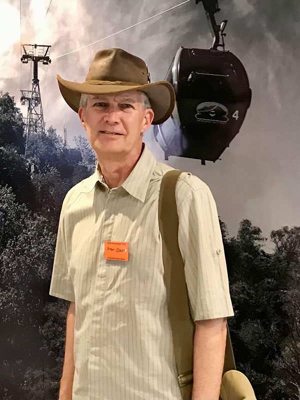
Simon Green
Simon is an expert on the blockhouses of the Anglo-Boer war.
Commissioned at the Royal Military Academy Sandhurst in 1978 into the Royal Corps of Signals, he served for nearly 30 years in military appointments in Europe, Brunei, and South Africa. He worked extensively in major military headquarters, giving him a unique insight into the staff who fight wars at a strategic level.
He retired from military service in 2006 and settled in South Africa to pursue his passion for military history and writing.
Simon has published two books on the topic telling the complete story of the Anglo-Boer War Blockhouses:
A Field Guide designed to show what legacy the Anglo-Boer left in terms of these defensive structures constructed across South Africa. Invaluable for the car glove compartment!
The Engineer’s Perspective, tells the story in detail of how these blockhouses, were conceived, how they were built, deployed and used, and how effective they were as a war-winning strategy.
Simon is available to do talks on blockhouses. You can contact him at the details below:
Contact: 083 790 5478
E-mail: simonbsr@gmail.com
To buy books: www.blockhouses.co.za

Rob Milne
Rob is a Registered Cultural and Site Tour Guide (GP5927) resident in Magaliesburg. He has developed Battlefield and Geoheritage Tours in and around the Cradle of Humankind and the Magaliesberg, “The Cradle of Geology”.
Geoheritage includes local geology, archaeology, ancient rock art, history and nature guiding. Tour venues include:
- Plumari Private Reserve: Nooitgedacht Battlefield and Geoheritage Tours on the summit of the Magaliesberg Mountains; Petroglyph Walk (Bushman rock engravings) close to African Hills Safari Lodge & Spa; Museum Tours at the Plumari Heritage Museum (where he is Museum Curator). Reservations: 082 416 1340 or 076 792 8107 (Rob).
- Nineteen 69 Restaurant: Kalkheuwel Battlefield and Geoheritage Tour. 076 926 3121 (Herman) or 076 792 8107 (Rob).
- Olive Tree Farm, near Magaliesburg: Battle of Nooitgedacht and Geoheritage Tour.
- Sibane Lodge (near Hekpoort): Dwarsvlei Battlefield and Geoheritage Tour. 087 012 5375 (Reservations) or 076 792 8107 (Rob).
Facebook: Rob Milne and RobMilne.com
Website: www.robmilne.com
Contact: rob@robmilne.com; rob@africanhillslodge.co.za; 076 792 8107

Tinus le Roux
Tinus le Roux is a military history enthusiast who started colourising Anglo-Boer War images in 2014. He also colourises World War II images, specifically those related to the South African Air Force. Several of his colourised images have been published in books and his Facebook page, Boer War Colourised Photographs, have thousands of loyal followers.
When he is not colourising images or racing on his mountain bike, Tinus runs a flour milling company in Cape Town. He previously worked as a design engineer at Denel.
Infused with colour, scenes from the Anglo-Boer War suddenly come to life in this striking collection of colourised photos from one of the biggest conflicts on South African soil.
The Anglo-Boer War, or South African War, pitted the two Boer republics of Transvaal and the Orange Free State against British imperial might. The effects of this devastating war on the political, economic and social landscape were felt long after its end.
Volume 1 covers the conventional part of the war from October 1899 to June 1900 when Lord Roberts occupied the Boer republics. The photos show the Boer strikes into Natal and the Cape Colony, the sieges of British garrison towns at Ladysmith, Kimberley and Mafeking, as well as some of the major battles of the war.
The Boer War in Colour contains many iconic photos from the war, as well as several previously unpublished images. Over the past 120 years, hundreds of books on the Anglo-Boer War have been published, but this will be the first to show this conflict in full colour – introducing a fresh perspective and transforming it into living history.
